

Photogrammetry course with drones
About our
The Drone Photogrammetry Course introduces the use of drones and specialized software for the accurate 3D reconstruction of terrain and objects. It explores aerial image capture, photogrammetric processing, and the generation of digital elevation models (DEMs), orthomasics, and point clouds. It focuses on practical applications in areas such as surveying, precision agriculture, infrastructure inspection, and mapping.
The course provides knowledge of flight planning, camera calibration, and the use of software such as Agisoft Metashape or similar. Participants learn to interpret and analyze the generated data, obtaining measurable and precise results for decision-making and spatial analysis. Emphasis is placed on best practices and safety regulations for drone flight and data collection.
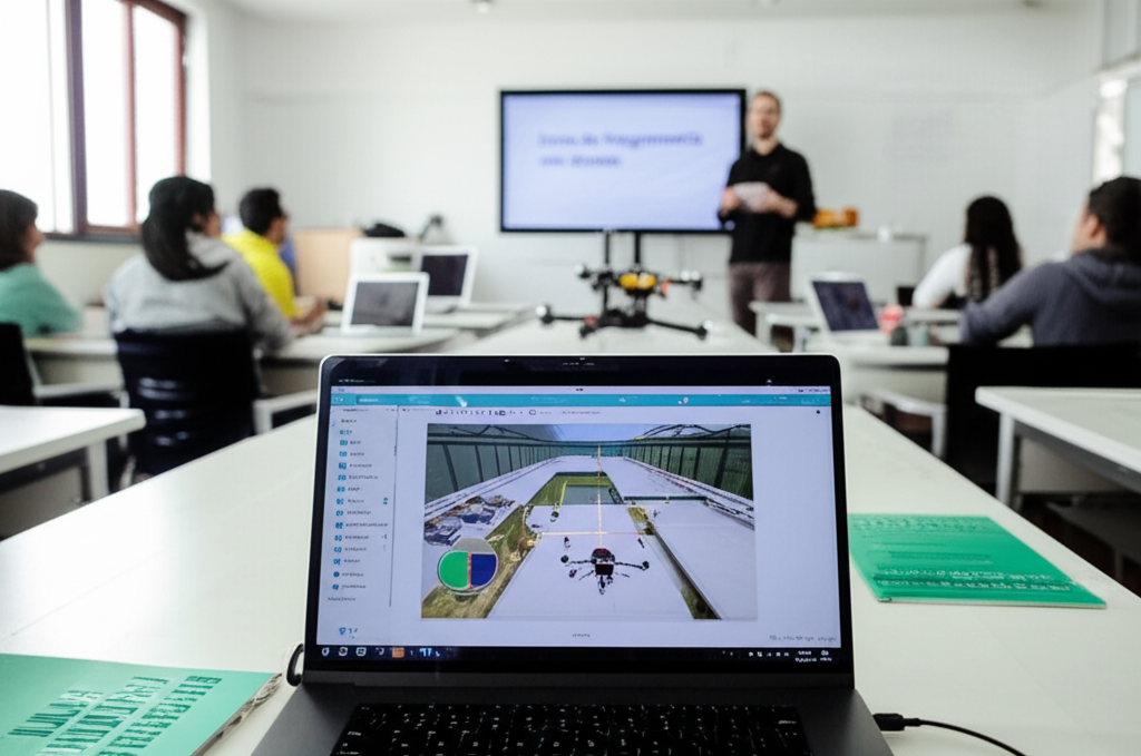
Photogrammetry course with drones
- Format: Hybrid
- Duration: 3 months
- Hours: 300 H
- Language: English / Spanish
- Registration date: 23-10-2026
- Start date: 12-12-2026
- Available places: 2
480 $
Competencies and results
What you will learn
1. Aerial Photogrammetry: From Flight to 3D Model with Drones
Here is the content you requested:
Understand the fundamentals of aerial photogrammetry and its applications.
Learn about the operation of drones and their essential components for image capture.
Master flight planning techniques for optimal data acquisition.
Become familiar with image processing and the generation of 3D models.
Use specialized software for creating orthomosaics and digital elevation models (DEMs).
Interpret and analyze the results obtained for various practical applications.
Explore case studies and real-world examples of drone photogrammetry applications.
Acquire knowledge about the precision and accuracy of the generated 3D models.
Understand the current regulations and standards for drone use.
Learn to apply aerial photogrammetry in different sectors such as surveying, construction, agriculture, and the environment.
2. In-depth Mastery of Drone Photogrammetry: Creation of Precise 3D Models
-
Fundamentals of Aerial Photogrammetry: Understand the basic principles governing the creation of 3D models from aerial photographs.
-
Drone Flight Planning: Learn to design and execute efficient and safe flight missions for image capture.
-
Equipment Setup and Calibration: Master drone and camera setup, including precise calibration for optimal results.
-
Data Acquisition: Gain hands-on experience in aerial image capture, using overlay techniques and ground control points (GCPs).
-
Image Processing and 3D Model Generation: Master specialized software for image processing, generating point clouds, 3D meshes, and orthomosaics.
- 3D Model Analysis and Measurement: Learn how to perform precise measurements, volume analysis, and report generation using created 3D models.
Applications of Drone Photogrammetry: Explore diverse applications in areas such as surveying, mapping, infrastructure inspection, precision agriculture, and natural resource management.
Model Optimization and Tuning: Learn how to optimize and tune 3D models to improve the accuracy and quality of results.
Legal and Safety Considerations: Understand the regulations and standards related to the use of drones and aerial photogrammetry.
Trends and Advances in Drone Photogrammetry: Stay up-to-date on the latest trends and technological advancements in the field.
3. Comprehensive user-oriented design and validation (from modeling to manufacturing)
You will learn to integrate the entire product development process, from initial model conception to final validation, applying user-centered methodologies. You will develop skills in parametric design, ergonomics, simulation, sustainable materials, 3D visualization, and manufacturing management, ensuring efficient, safe solutions that meet current industry standards.
4. Advanced Photogrammetry with Drones: Transforming Images into Detailed 3D Maps
4. Advanced Photogrammetry with Drones: Transforming Images into Detailed 3D Maps
- Master the fundamentals of photogrammetry and the use of drones for aerial image capture.
- Plan efficient drone flights for acquiring high-quality photogrammetric data.
- Learn image processing methods using specialized software to generate 3D models.
- Extract accurate metric information from 3D models, including distances, areas, and volumes.
- Apply advanced processing techniques, such as orthorectification and the creation of digital elevation models (DEMs) and digital surface models (DSMs).
- Understand different georeferencing techniques and their importance for data accuracy.
- Analyze and troubleshoot common errors in photogrammetric processing.
- Utilize the generated 3D models for various applications, such as mapping, infrastructure inspection, and resource management.
Explore the latest trends and technologies in drone photogrammetry, including the use of LiDAR sensors and artificial intelligence software.
Develop a practical photogrammetry project to apply the knowledge acquired and demonstrate the ability to generate detailed 3D maps.
5. Unlocking the Potential of Drones: Photogrammetry for Precise Modeling and Mapping
5. Unlocking the Potential of Drones: Photogrammetry for Precise Modeling and Mapping
- Fundamentals of Drone Photogrammetry: Exploring the basic principles and workflow.
- Drone Flight Planning: Designing efficient missions for photogrammetric data acquisition.
- Aerial Image Capture: Techniques for obtaining high-quality images, including camera adjustments and layering.
- Photogrammetric Data Processing: Using specialized software to create 3D models and orthomosaics.
- 3D Model Generation: Creating digital elevation models (DEMs) and digital surface models (DSMs).
- Orthomasaics and Mapping: Producing orthorectified maps and analyzing geospatial data.
- Applications of Drone Photogrammetry: Practical case studies in Various industries (surveying, construction, agriculture, etc.).
Accuracy Analysis: Evaluation of the accuracy and quality of photogrammetric results.
Regulations and Standards: Compliance with laws and regulations for drone flights.
Future Trends: Exploration of the latest innovations and developments in drone photogrammetry.
6. Drone Surveys: Photogrammetry for 3D Terrain Reconstruction
6. Drone Surveys: Photogrammetry for 3D Terrain Reconstruction
Planning autonomous flights for drone data capture.
Acquisition of high-resolution aerial images and overlay.
Photogrammetric processing for generating 3D terrain models.
Creation of digital elevation models (DEMs) and orthomosaics.
Analysis and interpretation of geospatial data for measuring areas, volumes, and distances.
Application of photogrammetry in topographic surveys, mapping, and environmental monitoring.
Use of specialized software for processing and analyzing drone data.
Generation of contour maps and terrain profiles.
Identification and classification of terrestrial features using 3D models.
Quality control and accuracy in drone surveys.
Who this program is for:
Photogrammetry course with drones
- Engineers, technicians, and other professionals with training in disciplines such as Civil Engineering, Surveying, Geodesy, Environmental Engineering, and related fields.
- Professionals in the agricultural, forestry, mining, infrastructure, construction, industrial inspection, and emergency management sectors.
- Technicians and specialists in the use of drones, drone pilots (experienced or in training) who wish to expand their knowledge and skills in photogrammetric data processing.
- Researchers and academics in areas of Remote sensing, geography, cartography, and related disciplines seeking to apply photogrammetry in their research projects.
- Profiles working for engineering firms, consulting firms, public administrations, and other organizations that require generating 3D models, orthomosaics, and other products derived from drone photogrammetry.
Recommended requirements: Basic knowledge of aerial photography, cartography principles, and software proficiency. Ability to learn and adapt to new technologies.
- Standards-driven curriculum: you will work with CS-27/CS-29, DO-160, DO-178C/DO-254, ARP4754A/ARP4761, ADS-33E-PRF from the first module.
- Accreditable laboratories (EN ISO/IEC 17025) with rotor bench, EMC/Lightning pre-compliance, HIL/SIL, vibrations/acoustics.
- Evidence-oriented TFM: safety case, test plan, compliance dossierand operational limits.
- Mentored by industry: teachers with experience in rotorcraft, tiltrotor, eVTOL/UAM and flight test.
- Flexible modality (hybrid/online), international cohorts and support from SEIUM Career Services.
- Ethics and security: safety-by-design approach, cyber-OT, DIH and compliance as pillars.
1.1 Fundamental Principles of Aerial Photogrammetry
1.2 Introduction to Drones and Their Components
1.3 Types of Cameras and Sensors for Photogrammetry
1.4 Drone Flight Planning
1.5 Data Acquisition: Configuration and Flight
1.6 Photogrammetric Processing Software: Overview
1.7 Georeferencing and Ground Control
1.8 3D Model Generation: Point Cloud and Mesh
1.9 Applications of Aerial Photogrammetry
1.10 Future Trends in Drone Photogrammetry
2.2 Introduction to Aerial Photogrammetry with Drones
2.2 Fundamentals of Aerodynamics and Drone Flight
2.3 Aeronautical Regulations and Legislation for Drones
2.4 Safety in Drone Operations
2.5 Flight Planning for Photogrammetry
2.6 Meteorology and its Impact on Drone Flights
2.7 Hardware and Software for Photogrammetry
2.8 First Steps in Data Capture
2.9 Safety Standards and Best Practices
2.20 Incident Preparedness and Prevention
3.3 Introduction to Aerial Photogrammetry and its Applications
3.2 Basic Principles of Drone Photogrammetry
3.3 Types of Drones and Camera Systems for Photogrammetry
3.4 Legislation and Regulations for Drone Flights
3.5 Safety in Drone Operations and Risk Prevention
3.6 Flight Planning and Data Acquisition
3.7 Camera Calibration and Reference Systems
3.8 Introduction to Photogrammetric Processing Software
3.9 Data Analysis and Quality Control
3.30 Case Studies and Application Examples
4.4 Introduction to Drones: Types and Components
4.2 Legislation and Regulations: Airspace, Permits, and Restrictions
4.3 Flight Safety: Protocols and Prevention Measures
4.4 Getting Started: Drone Setup and Calibration
4.5 Remote Pilot: Skills and Responsibilities
4.6 Basic Flight: Takeoff, Landing, and Maneuvers
4.7 Preventive Maintenance: Drone Care and Upkeep
4.8 Legal Aspects: Insurance, Registration, and Documentation
2.4 Fundamental Concepts: What is Aerial Photogrammetry?
2.2 Principles of Photogrammetry: Image Geometry
2.3 Types of Projections: Perspective, Orthophotography
2.4 Reference Systems: Geographic Coordinates and Projections
2.5 Errors and Sources of Error: Accuracy and Precision
2.6 Image Generation: Overlap and Clarification
2.7 Elements of a 3D Model: Point Cloud, Mesh, Textures
2.8 From Flight to Model: Photogrammetric Workflow
3.4 Area Definition: Delimitation and Scale
3.2 Mission Design: Flight Routes and Parameters
3.3 Flight Altitude: Desired Height and Resolution
3.4 Clarification: Calculation and Configuration
3.5 Flight Planning: Planning Software
3.6 Environmental Factors: Wind, Light, and Weather Conditions
3.7 Plan Verification: Simulation and Adjustments
3.8 Flight Execution: Real-Time Controls and Monitoring
4.4 Equipment Selection: Cameras, Sensors, and Drones
4.2 Camera Configuration: Capture Parameters
4.3 Image Acquisition: Techniques and Strategies
4.4 Calibration of The Camera: Process and Importance
4.5 Ground Control Points (GCPs): Measurement and Location
4.6 Reference Markers: Placement and Recognition
4.7 Data Acquisition: Protocols and Recording
4.8 Quality Control: Verification and Adjustments in the Field
5.4 Introduction to the Software: Selection and Functions
5.2 Data Import: Formats and Compatibility
5.3 Image Alignment: Process and Optimization
5.4 Point Cloud Generation: Density and Quality
5.5 Mesh Generation: Types and Adjustments
5.6 Texturing: Applying Textures and Maps
5.7 Model Editing: Error Correction
5.8 Data Export: Formats and Options
6.4 3D Model Generation: Creation and Visualization
6.2 Orthomosaics: Creation and Calibration
6.3 Generation of Digital Models of Elevation (DEM)
6.4 Generation of Digital Surface Models (DSM)
6.5 Model Interpretation: Visual Analysis
6.6 Quality Control: Evaluation and Adjustments
6.7 Model Export: Formats and Applications
6.8 GIS Integration: Import and Analysis
7.4 Measurement of Distances, Areas, and Volumes
7.2 Terrain Analysis: Slopes, Curvatures, and Zones
7.3 Terrain Modeling: Contour Lines
7.4 Environmental Analysis: Vegetation, Impact, and Change
7.5 Infrastructure Inspection: Bridges, Buildings, etc.
7.6 Precision Agriculture: Crop Analysis
7.7 Geological Studies: Soil Mapping and Analysis
7.8 Results Presentation: Reports and Visualizations
8.4 Precision Metrics: Root Mean Square Error (RMSE)
8.2 Precision Evaluation: Methods and Techniques
8.3 Factors Affecting Precision: Height, Overlap, GCP
8.4 Camera Calibration: Importance for Precision
8.5 GCP Design: Number, Distribution, and Quality
8.6 Precision Optimization: Adjustments and Improvement
8.7 Precision Reporting: Documentation and Presentation
8.8 Quality Control: Quality Assurance
5.5 Fundamentals of Aerial Photogrammetry with Drones: Introduction
5.5 Flight Planning for Photogrammetry: Optimal Configuration
5.3 Image Capture: Techniques and Tips for Drones
5.4 Data Processing: Photogrammetry Software
5.5 3D Model Generation: Meshes and Point Clouds
5.6 Orthophotos: Creation and Applications
5.7 Geographic Data Analysis: Measurements and Calculations
5.8 Practical Applications: Case Studies
5.9 Legislation and Regulations: Drone Flight
5.50 Future Trends: Innovation in Aerial Photogrammetry
6.6 Flight Planning and Data Acquisition for Photogrammetry
6.2 Drone Configuration and Calibration for Surveys
6.3 Aerial Image Capture Techniques for 3D Modeling
6.4 Photogrammetric Data Processing: Software and Workflows
6.5 Generation of Orthorectified 3D Models and Mosaics
6.6 Analysis and Measurement in 3D Models: Distances, Areas, and Volumes
6.7 Creation of Digital Elevation Maps (DEMs) and Digital Terrain Models (DTMs)
6.8 Quality Control and Accuracy in 3D Models
6.9 Applications of Photogrammetry in Terrain Reconstruction
6.60 Case Studies: Practical Examples and Real-World Projects
- Hands-on methodology: test-before-you-trust, design reviews, failure analysis, compliance evidence.
- Software (depending on licenses/partners): MATLAB/Simulink, Python (NumPy/SciPy), OpenVSP, SU2/OpenFOAM, Nastran/Abaqus, AMESim/Modelica, acoustics tools, planning toolchains DO-178C.
- SEIUM Laboratories: scale rotor bench, vibrations/acoustics, EMC/Lightning pre-compliance, HIL/SIL for AFCS, data acquisition with strain gauging.
- Standards and compliance: EN 9100, 17025, ISO 27001, GDPR.
Capstone-type projects
- Coastal 3D Modeling: High-resolution orthomosaics and DSMs for mapping.
- Naval Infrastructure Analysis: 3D inspection of docks and piers.
- Bathymetric Studies: Integration of LiDAR and photogrammetric data for seabed modeling.
- Maritime Surveillance: Detection of vessels and floating objects.
- 3D Coastal Mapping: Precise 3D models for erosion analysis and planning.
- Environmental Monitoring: Detection of pollutants and impact analysis in coastal areas.
- Naval Inspection: 3D models for hull and structure inspection, and damage detection.
- Port Planning: 3D mapping for space optimization and resource management.
- Naval 3D Modeling: Integration of drone photogrammetry (3D models of ships and ports).
- Precise Coastal Mapping: Generation of high-resolution bathymetric and terrestrial maps.
- Digital Naval Inspection: Detection of damage to hulls and structures using 3D models.
- Naval Environment Simulation: Creation of 3D environments for training and simulation.
- 3D Coastal Mapping: Digital Elevation Models (DEMs) and orthomosaics for erosion analysis and infrastructure planning.
Admissions, fees, and scholarships
- Profile: Background in Computer Engineering, Mathematics, Statistics, or related fields; practical experience in NLP and valued information retrieval systems.
- Documentation: Updated CV, academic transcript, SOP/statement of purpose, project examples or code (optional).
- Process: Application → Technical evaluation of profile and experience → Technical interview → Review of case studies → Final decision → Enrollment.
- Fees:
- Single payment: 10% discount.
- Payment in 3 installments: No fees; 30% upon registration + 2 equal monthly payments of the remaining 35%.
Monthly payment: available with a 7% commission on the total; annual review.
Scholarships: based on academic merit, financial need, and promoting inclusion; agreements with companies in the sector for partial or full scholarships.
See “Calendar & Calls for Applications,” “Scholarships & Grants,” and “Fees & Financing” in the SEIUM mega-menu.
Do you have any questions?
Our team is ready to help you. Contact us, and we will respond as soon as possible.
F. A. Q
Frequently asked questions
Yes, we have international certification
Yes: experimental models, real data, applied simulations, professional environments, real case studies.
It is not mandatory. We offer leveling tracks and tutoring.
Completely. It covers e-propulsion, integration, and emerging regulations (SC-VTOL).
Recommended. There are also internal challenges and consortiums.
Yes. Online/hybrid modality with planned labs and visa support (see “Visa & Residence”).