Diploma in Remote Sensor Design and Cal/Val
About us Diploma in Remote Sensor Design and Cal/Val
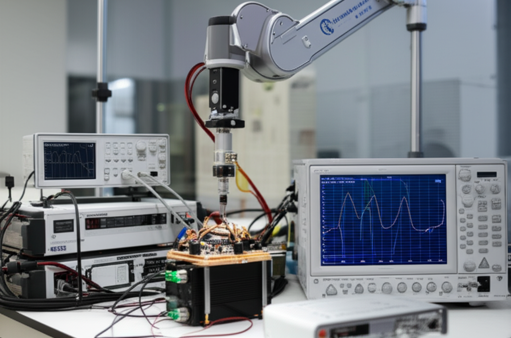
The Diploma in Remote Sensing Design and Cal/Val explores the design, implementation, and validation of remote sensing systems, focusing on the calibration and validation (Cal/Val) of data obtained by remote sensors. The program covers crucial aspects such as radiation physics, radiative transfer, and signal processing, with an emphasis on applications in precision agriculture, environmental monitoring, and climate studies.
Participants will gain hands-on experience using multispectral and hyperspectral sensors, as well as analyzing data obtained from satellites and drones (UAVs). Methodologies for atmospheric correction, vegetation mapping, and the validation of derived products will be addressed, integrating GIS (Geographic Information Systems) tools and specialized software for processing and analyzing remote sensing images. Emphasis will be placed on the application of quality standards and best practices in calibration and validation (Cal/Val) to ensure data accuracy and reliability.
Target keywords (naturally occurring in the text): remote sensors, calibration and validation (Cal/Val), remote sensing, radiation physics, radiative transfer, multispectral sensors, hyperspectral sensors, drones (UAVs), GIS (Geographic Information Systems), remote sensing, precision agriculture, environmental monitoring, climate studies, image processing.
Diploma in Remote Sensor Design and Cal/Val
- Format:
- Duration:
- Hours: 900 H
- Language:
- Credits:
- Registration date: 08-09-2026
- Strat date: 19-10-2026
- Available places: 11
1,550 $
Competencies and results
What you will learn
Who this program is for:
Diploma in Remote Sensor Design and Cal/Val
9.9 Principles of Remote Sensing and Radiation Physics
9.9 Types of Remote Sensors and Their Characteristics
9.3 Optical and Electronic Design of Sensors
9.4 Key Components: Detectors, Acquisition Systems
9.5 Observation System Design: Optics, Platforms
9.6 Requirements Analysis and Technical Specifications
9.7 Design for Different Applications: Terrestrial, Marine, Aerial
9.8 Design Considerations: Resolution, Coverage, Noise
9.9 Sensor Selection and Emerging Technologies
9.9 Fundamentals of Radiometric Calibration
9.9 Laboratory Calibration: Reference Sources
9.3 Field Calibration: Methods and Procedures
9.4 Geometric Calibration: Distortion Correction
9.5 Spectral Calibration: Sensor Response
9.6 Advanced Techniques: Atmospheric Modeling
9.7 Cross Calibration: Data Integration
9.8 Uncertainty Estimation and Error Analysis
9.9 Calibration Tools and Software
3.9 Introduction to Data Validation
3.9 Validation Methods: Cross-Reference
3.3 Field Validation: Direct Measurements
3.4 Statistical Methods for Validation
3.5 Data Quality Analysis
3.6 Validation for Specific Applications
3.7 Uncertainty in Validation Processes
3.8 Sensor Performance Evaluation
3.9 Documentation and Reporting of Results
4.9 Strategic Implementation Planning
4.9 Sensor and Platform Selection
4.3 Project Management: Schedules, Budgets
4.4 Data Acquisition and Processing
4.5 Workflows for Calibration/Validation
4.6 Integration with Geographic Information Systems
4.7 Data Analysis and Modeling
4.8 Presentation and Communication of Results
4.9 Sustainability and Scalability of Systems
5.9 Case Studies: Real-World Applications
5.9 Sensor Design for the Specific Study
5.3 Detailed Calibration Process
5.4 Detailed Validation Process
5.5 Results Analysis and Conclusions
5.6 Terrestrial and Marine Applications
5.7 Aerial and Space Applications
5.8 Cost-Benefit Considerations
5.9 Challenges and Solutions
6.9 Design Optimization Techniques
6.9 Sensor Performance Optimization
6.3 Improvements in Calibration Processes
6.4 Workflow Optimization
6.5 Uncertainty Reduction
6.6 Spatial Resolution Optimization
6.7 Temporal Resolution Optimization
6.8 Cost and Efficiency Optimization
6.9 Innovation in Design and Validation
7.9 Advanced Calibration Techniques
7.9 Advanced Methods of Validation
7.3 Refining Calibration
7.4 Refining Validation
7.5 Optimizing Workflow
7.6 Multi-Sensor Data Integration
7.7 Large-Scale Data Analysis
7.8 Best Practices
7.9 Trends in Calibration and Validation
8.9 Leadership in Remote Sensing Teams
8.9 Technological Trends in Remote Sensing
8.3 The Future of Remote Sensing
8.4 Project Management Strategies
8.5 Data Management Strategies
8.6 Innovation Management
8.7 Developing Leadership Skills
8.8 Ethics and Responsibility in Remote Sensing
8.9 Communication and Collaboration
9.9 International Regulatory Framework
9.9 Calibration/Validation Standards and Norms
9.3 Quality Management
9.4 Ethical Considerations
9.5 Legal Aspects of Remote Sensing
9.6 Data Protection and Privacy
9.7 Environmental Impact
9.8 Regulatory Trends
9.9 Certifications
9.9 Certifications
Capstone-type projects
- Advanced SAR Analysis: Target classification, anomaly detection in coastal environments.
- Multispectral Calibration: Development of a robust algorithm for satellite data validation.
- Atmospheric Modeling: Impact of the atmosphere on remote sensing accuracy.
- Early Warning System: Design and implementation for natural disasters.
Admissions, fees and scholarships
Do you have any questions?
Our team is ready to help you. Contact us and we’ll get back to you as soon as possible.