

Flood Modeling Course with HEC-RAS 2D
About our
The HEC-RAS 2D Flood Modeling Course teaches how to simulate water flow and flood propagation using HEC-RAS 2D software. It includes the use of tools for creating hydrological and hydraulic models, configuring topographic data, and performing flood simulations through 2D flow analysis. Participants learn to interpret simulation results, generate flood maps, and assess associated risks, which are fundamental for water resource management and urban planning.
The course offers hands-on experience in creating models and analyzing flood scenarios, using LiDAR data and other information sources. It focuses on the application of techniques for model calibration and validation, allowing for the assessment of flood impacts and the development of mitigation and risk management strategies, applying this knowledge to civil engineering, hydrology, and environmental management projects. Learning is complemented by the use of GIS (Geographic Information Systems) for spatial analysis and results presentation.
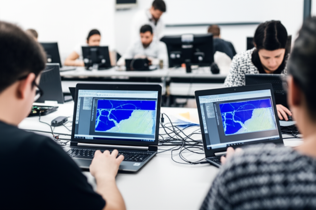
Flood Modeling Course with HEC-RAS 2D
- Format: Online
- Duration: 3 months
- Hours: 300 H
- Language: English / Spanish
- Registration date: 23-10-2026
- Start date: 12-12-2026
- Available places: 3
249 $
Competencies and results
What you will learn
1. Mastery of Two-Dimensional Flood Modeling with HEC-RAS 2D
- Understand the theoretical foundations of two-dimensional flood modeling.
- Use HEC-RAS 2D software to simulate complex flood events.
- Import and process topographic and hydrological data for model creation.
- Set up and run flood simulations, including defining boundary conditions and modeling parameters.
- Analyze simulation results, interpreting flood maps, depths, velocities, and arrival times.
- Calibrate and validate HEC-RAS 2D models using observed data.
- Apply 2D modeling to assess the impact of flooding in different scenarios, such as changes in land use or infrastructure modifications.
- Develop skills in interpreting results and preparing technical reports on flood studies.
- Learn advanced techniques, such as modeling of hydraulic structures (bridges, dams) in the 2D model.
Apply HEC-RAS 2D modeling in flood risk management and decision-making.
1. Comprehensive Experience in 2D Flood Simulation with HEC-RAS
-
Understand and apply the theoretical foundations of 2D flood simulation with HEC-RAS.
-
Configure and run 2D flood simulation models in HEC-RAS, using the software’s tools and functionalities.
-
Analyze simulation results, including flood maps, depth and velocity profiles, and other relevant parameters.
-
Interpret simulation results to identify risk areas, assess the impact of different flood scenarios, and develop mitigation strategies.
-
Learn to use HEC-RAS post-processing tools to effectively visualize and communicate simulation results.
-
Apply 2D flood simulation with HEC-RAS to a variety of case studies, including real-world watersheds and design scenarios.
-
Become familiar with industry best practices and standards for flood simulation with HEC-RAS.
-
Develop problem-solving and decision-making skills based on simulation results.
-
Explore advanced HEC-RAS capabilities, such as dam break simulation, sediment modeling, and uncertainty analysis.
Acquire practical skills in preparing input data for HEC-RAS models, including topographic, hydrological, and hydraulic data.
3. Comprehensive user-oriented design and validation (from modeling to manufacturing)
You will learn to integrate the entire product development process, from initial model conception to final validation, applying user-centered methodologies. You will develop skills in parametric design, ergonomics, simulation, sustainable materials, 3D visualization, and manufacturing management, ensuring efficient, safe solutions that meet current industry standards.
4. Implementation and Analysis of 2D Flood Models with HEC-RAS
## What will you learn in the HEC-RAS 2D Flood Model Implementation and Analysis course?
- Understand the theoretical foundations of 2D hydrodynamic modeling with HEC-RAS.
- Acquire knowledge about preparing input data for 2D models, including terrain data (DEM), roughness data, and boundary conditions.
- Learn how to set up and run 2D flood models in HEC-RAS, including defining the mesh, selecting simulation parameters, and specifying initial conditions.
- Analyze the results of 2D flood models, including visualizing flood maps and extracting data on water depth, velocity, and arrival time.
- Interpret flood analysis results for risk assessment and decision-making in flood management.
- Learn how to calibrate and validate 2D flood models with field data and observations.
- Explore different applications of 2D flood models, such as urban planning, Water resource management and environmental impact assessment.
Become familiar with advanced HEC-RAS tools for modeling complex scenarios, such as dam break modeling and river overflow flooding events.
Develop practical skills in implementing and analyzing 2D flood models, using real-world examples and case studies.
Use HEC-RAS for risk management, identifying flood zones, and making decisions about urban planning and development.
5. Advanced Implementation and Application of HEC-RAS 2D for Flood Studies
Master 2D hydrodynamic modeling using HEC-RAS.
Understand the theoretical foundations of two-dimensional flood modeling.
Configure and process input data for 2D HEC-RAS models (topography, hydrological data, etc.).
Apply different numerical resolution methods in HEC-RAS to simulate water flow.
Analyze and visualize the results of flood simulations (depth, velocity, etc.).
Perform sensitivity and calibration studies of 2D HEC-RAS models.
Apply HEC-RAS 2D to assess flood risks and design mitigation measures.
Integrate 2D HEC-RAS models with other geospatial tools and data.
Learn advanced modeling techniques, such as structural simulation and dam break modeling.
Develop practical skills in interpreting results and making decisions based on HEC-RAS 2D models.
6. Advanced 2D Flood Modeling with HEC-RAS: Applications and Analysis
- Apply HEC-RAS in real-world case studies and practical projects.
Understand the theoretical foundations of 2D flood modeling with HEC-RAS.
Learn how to configure and prepare hydrological and hydrodynamic data for the model.
Master the creation and editing of terrain geometries and hydraulic structures.
Run flood simulations and analyze detailed results.
Interpret flood maps, including depths, velocities, and boundaries.
Perform flood risk analysis and impact assessments.
Explore advanced applications of HEC-RAS, such as dam failure modeling and climate change scenarios.
Use post-processing tools to visualize and communicate results effectively.
Develop decision-making skills in flood management and urban planning.
Who this program is for:
Flood Modeling Course with HEC-RAS 2D
- Engineers, hydrologists, and professionals in Civil Engineering, Environmental Engineering, Water Resources Engineering, or related disciplines.
- Technicians and specialists in flood risk management, urban planning, and land use planning.
- Officials from government agencies and environmental authorities with responsibilities in water management and disaster prevention.
- Consultants and advisors working on hydrological modeling projects and environmental impact studies.
- Standards-driven curriculum: you will work with CS-27/CS-29, DO-160, DO-178C/DO-254, ARP4754A/ARP4761, ADS-33E-PRF from the first module.
- Accreditable laboratories (EN ISO/IEC 17025) with rotor bench, EMC/Lightning pre-compliance, HIL/SIL, vibrations/acoustics.
- Evidence-oriented TFM: safety case, test plan, compliance dossierand operational limits.
- Mentored by industry: teachers with experience in rotorcraft, tiltrotor, eVTOL/UAM and flight test.
- Flexible modality (hybrid/online), international cohorts and support from SEIUM Career Services.
- Ethics and security: safety-by-design approach, cyber-OT, DIH and compliance as pillars.
**Module 1 — Introduction to HEC-RAS 2D: Fundamentals and Concepts**
1.1 Introduction to 2D Flood Models: Basic Concepts and Applications
1.2 HEC-RAS 2D Fundamentals: Interface, Structure, and Components
1.3 Data Preparation: Topography, Elevations, and Meshes
1.4 Simulation Configuration: Hydrological and Hydraulic Parameters
1.5 Running and Monitoring 2D Simulations
1.6 Visualizing and Analyzing Initial Results
1.7 Interpreting Flood Maps and Key Variables
1.8 Validating and Calibrating Basic Models
1.9 Limitations and Initial Considerations
1.10 Introduction to Simple Case Studies
2.2 Introduction to 2D Simulation with HEC-RAS: Fundamentals and Key Concepts
2.2 Data Preparation: Topography, Meshes, and Boundary Conditions
2.3 2D Model Construction: Geometry, Hydraulic Parameters, and Calibration
2.4 Flood Simulation: Execution and Analysis of Initial Results
2.5 Results Analysis: Flood Maps, Depth, Velocity, and Time of Arrival
2.6 Advanced Techniques: Mesh Refinement and Model Optimization
2.7 Modeling Structures: Bridges, Dams, and Other Hydraulic Works
2.8 Scenario Analysis: Evaluation of Different Flow Rates and Frequencies
2.9 GIS Integration: Visualization and Spatial Analysis of Results
2.20 Practical Applications: Impact Studies, Design of Mitigation Measures, and Risk Management
3.3 Theoretical Foundations of 2D Flood Analysis
3.2 Data Preparation and Organization for 2D Modeling
3.3 Definition of Boundary Conditions and Flood Scenarios
3.4 Configuration of Hydraulic Parameters in HEC-RAS 2D
3.5 Simulation and Execution of 2D Models in HEC-RAS
3.6 Results Analysis: Interpretation of Flood Maps
3.7 Results Analysis: Evaluation of Depths and Velocities
3.8 Risk and Vulnerability Analysis in Flood-Prone Areas
3.9 Validation and Calibration of 2D Models
3.30 Case Studies: Practical Applications and Comparative Analysis
4.4 Introduction to Implementing 2D Models in HEC-RAS
4.2 Data Preparation: Terrain Geometry and Boundary Conditions
4.3 Model Configuration: Hydrological and Hydraulic Parameters
4.4 Flood Simulation: Execution and Initial Results
4.5 Visualization and Basic Analysis of Results
4.6 Model Calibration: Parameter Adjustment and Validation
4.7 Sensitivity Analysis: Impact of Model Variables
4.8 Practical Applications: Flood Scenarios and Structure Design
4.9 Interpretation and Communication of Results
4.40 Advanced Tools: Risk Analysis and Flood Maps
5.5 Introduction to HEC-RAS 5D and its application in flood modeling
5.5 Principles of 5D hydrodynamic modeling
5.3 Preparing input data: Topography, elevation maps, and boundary conditions
5.4 Configuring the 5D model: Defining the mesh, roughness parameters, and simulation time
5.5 Running and visualizing basic results: Depth, velocity, and time-of-arrival maps
5.5 Review of basic HEC-RAS 5D concepts
5.5 Creating and configuring complex 5D models
5.3 Importing and processing terrain data for 5D simulation
5.4 Defining hydraulic and atmospheric boundary conditions
5.5 Running simulations and preliminary analysis of results
3.5 Analyzing output data from 5D flood models
3.5 Interpreting results: Depths, velocities, and flooded areas
3.3 Flood risk assessment: Hazard maps and flood zones
3.4 Sensitivity analysis of model parameters
3.5 Generating reports and visualizing results for decision-making
4.5 Selecting the appropriate 5D model type (diffusion, full wave)
4.5 Implementing 5D models in different flood scenarios
4.3 Calibration and validation of HEC-RAS 5D models
4.4 Integrating 5D models with other models (e.g., 5D)
4.5 Developing case studies and studying scenarios
5.5 Advanced applications of HEC-RAS 5D: Modeling bridges, structures, and obstacles
5.5 Incorporating rainfall and runoff data into 5D models
5.3 Flood analysis in urban and rural areas
5.4 Simulating dam break scenarios
5.5 Using HEC-RAS 5D for flood management and urban planning
6.5 Advanced mesh modeling techniques 5D (structured and unstructured meshes)
6.5 Modeling turbulence and complex phenomena in HEC-RAS 5D
6.3 Analyzing erosion and sedimentation in 5D models
6.4 Optimizing models to improve computational efficiency
6.5 Applications of advanced models in environmental impact studies
7.5 Detailed simulation of flood events with HEC-RAS 5D
7.5 Analyzing flood propagation and its impact on structures
7.3 Modeling different types of floods (pluvial, fluvial, coastal)
7.4 Integrating GIS data and advanced visualization tools
7.5 Real-world case studies and practical applications
8.5 Comprehensive review of all aspects of 5D modeling with HEC-RAS
8.5 Designing models from data collection to results interpretation
8.3 Integrating HEC-RAS 5D with other tools and software
8.4 Best practices in modeling Floods and water resources management
8.5 Presentation of final projects and discussion of complex case studies
6.6 Fundamentals of Advanced Modeling with HEC-RAS 2D: Introduction to advanced techniques and complex scenarios.
6.2 Data Preparation for Advanced Models: Importing, preprocessing, and managing complex data.
6.3 2D Flow Simulation with Complex Boundary Conditions: Implementation and analysis of different types of conditions.
6.4 Advanced Hydraulic Structure Modeling: Detailed incorporation of bridges, dams, and other structures.
6.5 Calibration and Validation of Advanced Models: Techniques to ensure the accuracy and reliability of simulations.
6.6 Sensitivity Analysis and Model Optimization: Identifying critical parameters and optimizing performance.
6.7 Interpretation of Advanced Results: Visualization and analysis of complex results, including risk and vulnerability maps.
6.8 Specific Applications: Flood studies in urban, coastal, and rural areas. 6.9 Advanced Case Studies: Analysis of real-world examples and resolution of complex problems.
6.60 Final Report and Presentation of Results: Preparation of detailed technical reports and effective communication of findings.
- Hands-on methodology: test-before-you-trust, design reviews, failure analysis, compliance evidence.
- Software (depending on licenses/partners): MATLAB/Simulink, Python (NumPy/SciPy), OpenVSP, SU2/OpenFOAM, Nastran/Abaqus, AMESim/Modelica, acoustics tools, planning toolchains DO-178C.
- SEIUM Laboratories: scale rotor bench, vibrations/acoustics, EMC/Lightning pre-compliance, HIL/SIL for AFCS, data acquisition with strain gauging.
- Standards and compliance: EN 9100, 17025, ISO 27001, GDPR.
Capstone-type projects
- Risk Analysis in Coastal Zones: 2D HEC-RAS modeling, vulnerability assessment.
- Resilient Urban Planning: Flood simulation, mitigation strategy design.
- Emergency Management: 2D HEC-RAS, flood simulation, evacuation route optimization.
- HEC-RAS 2D Analysis: Modeling and simulation of floods in complex scenarios.
- Data and Calibration: Collection, processing, and validation of hydrological data.
- Risk Scenarios: Assessment of flood impacts, design of mitigation measures.
- Practical Applications: Case studies, design of models for coastal areas.
- 2D Flood Modeling: HEC-RAS simulation, risk analysis, flood maps.
- 2D HEC-RAS Analysis: Flood scenario modeling; risk mapping; impact assessment in urban areas.
- Advanced Simulation: Model calibration and validation; sensitivity analysis; flood prediction.
- Practical Applications: Resilient infrastructure design; risk management; evacuation plans.
Admissions, fees, and scholarships
- Profile: Background in Computer Engineering, Mathematics, Statistics, or related fields; practical experience in NLP and valued information retrieval systems.
- Documentation: Updated CV, academic transcript, SOP/statement of purpose, project examples or code (optional).
- Process: Application → Technical evaluation of profile and experience → Technical interview → Review of case studies → Final decision → Enrollment.
- Fees:
- Single payment: 10% discount.
- Payment in 3 installments: No fees; 30% upon registration + 2 equal monthly payments of the remaining 35%.
Monthly payment: available with a 7% commission on the total; annual review.
Scholarships: based on academic merit, financial need, and promoting inclusion; agreements with companies in the sector for partial or full scholarships.
See “Calendar & Calls for Applications,” “Scholarships & Grants,” and “Fees & Financing” in the SEIUM mega-menu.
Do you have any questions?
Our team is ready to help you. Contact us, and we will respond as soon as possible.
F. A. Q
Frequently asked questions
Yes, we have international certification
Yes: experimental models, real data, applied simulations, professional environments, real case studies.
It is not mandatory. We offer leveling tracks and tutoring.
Completely. It covers e-propulsion, integration, and emerging regulations (SC-VTOL).
Recommended. There are also internal challenges and consortiums.
Yes. Online/hybrid modality with planned labs and visa support (see “Visa & Residence”).