

Emergency drone course
About our
The Emergency Drone Course trains participants in the use of unmanned aerial vehicles (UAVs) for rescue operations and disaster response. The program covers flight planning, safe operation, aerial imagery, and real-time data transmission, including specialized sensors such as thermal and multispectral cameras. It focuses on the application of drones for search and rescue, damage assessment, and humanitarian aid delivery, with an emphasis on compliance with aviation regulations and data privacy. Participants gain hands-on experience in drone configuration and operation, geospatial data processing, and effective communication with emergency teams. The training is geared towards professionals from fire departments, civil protection agencies, medical personnel, and volunteers, preparing them for roles such as drone operators, aerial data analysts, and emergency response coordinators, improving efficiency and safety in critical situations.
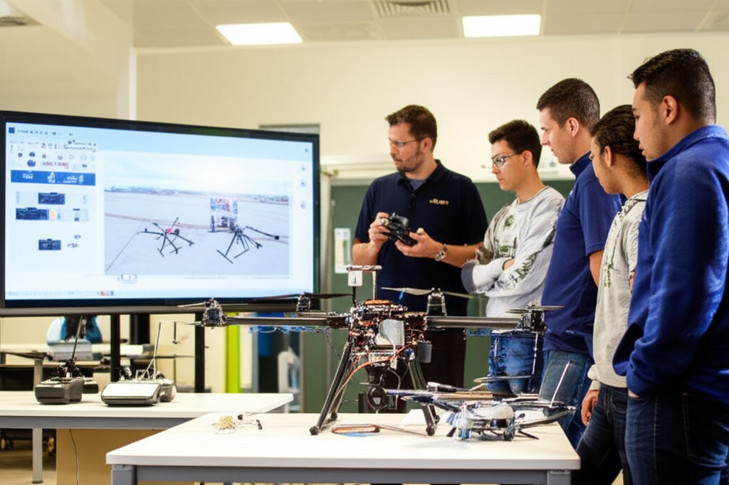
Emergency drone course
- Format: Hybrid
- Duration: 3 months
- Hours: 300 H
- Language: English / Spanish
- Registration date: 23-10-2026
- Start date: 12-12-2026
- Available places: 3
320 $
Competencies and results
What you will learn
1. Search and rescue operations with drones
- Planning and execution of search and rescue missions using drones.
- Navigation and control of drones in maritime and coastal environments.
- Identification and handling of equipment and technologies specific to SAR operations with drones.
- Search and tracking techniques for people at sea, using drone sensors and cameras.
- Data analysis and image processing for locating and rescuing victims.
- Legislation and regulations applicable to drone operations in the naval and SAR fields.
- Communication and coordination protocols with rescue teams and competent authorities.
- Risk assessment and safety measures in drone operations.
- Basic maintenance and repair of drones and their associated systems.
- Case studies and simulations of search and rescue operations with drones.
2. Drones in emergency scenarios: Key techniques and applications
- Identify and evaluate the types of drones used in emergencies: multirotors, fixed-wing, and hybrid.
- Understand the aviation regulations and rules for drone flight in emergency situations.
- Master the techniques for planning and executing drone missions in various emergency scenarios.
- Learn to use telemetry and remote control systems for the safe operation of drones.
- Acquire knowledge about the sensors and equipment used on drones for data collection in emergencies (cameras, thermal sensors, etc.).
- Apply data processing and analysis techniques to data obtained by drones for decision-making.
- Become familiar with the key applications of drones in emergencies: search and rescue, damage assessment, aid delivery, etc.
- Study real-world case studies of drone use in emergencies at various levels.
worldwide.
Practice simulations and practical exercises in drone flight and operation in emergency scenarios.
Learn about trends and technological advances in the field of emergency drones.
3. Comprehensive user-oriented design and validation (from modeling to manufacturing)
You will learn to integrate the entire product development process, from initial model conception to final validation, applying user-centered methodologies. You will develop skills in parametric design, ergonomics, simulation, sustainable materials, 3D visualization, and manufacturing management, ensuring efficient, safe solutions that meet current industry standards.
4. Aerial Navigation, Sensors and Mission Management with Emergency Drones
4. Air Navigation, Sensors, and Mission Management with Emergency Drones
- Principles of Air Navigation: You will understand the fundamentals of air navigation, including aerodynamics, meteorology, and flight planning, as applied to drones.
- Advanced Sensor Systems: You will explore the different types of sensors used in emergency drones, such as thermal cameras, LiDAR sensors, and gas detection sensors, and learn how they work and are integrated.
- Mission Management Techniques: You will master the design and execution of drone missions, including route planning, battery management, and the coordination of multiple drones.
- Emergency Operations: You will gain knowledge about the use of drones in emergency situations, such as search and rescue, disaster assessment, and supply delivery.
- Regulations and Safety: You will become familiar with the regulations and safety protocols for operating drones in emergency environments. Emergency.
- Data Analysis and Image Processing: You will learn to analyze the data collected by drone sensors and process images to obtain valuable information.
- Communications and Data Link: You will understand how the communication and data link systems used by drones work, and how to maintain a stable connection during missions.
- Implementation of Safety Protocols and Fault Response: You will learn to identify and mitigate the risks associated with drone operations, including technical failures and human error.
- Simulation and Training: You will use flight simulators and training platforms to practice your flying and mission management skills.
5. Evaluation and optimization of drone flight in critical situations
- Identify and understand critical flight maneuvers that test the structural integrity of drones.
- Evaluate drone performance under adverse conditions, including high winds, turbulence, and emergency situations.
- Apply stability and control analysis techniques to optimize flight in extreme situations.
- Analyze the factors that influence the aerodynamic stability of drones, such as weight distribution, center of gravity, and wing area.
- Master the use of flight simulations and software tools to predict drone behavior in critical situations.
- Implement flight optimization strategies to improve safety and efficiency in emergency situations, such as engine failure or loss of control.
- Understand and apply emergency procedures to mitigate risks and ensure the safety of the aircraft and the environment.
- Learn to evaluate and optimize the Flight in crosswinds, gusts, and other adverse weather conditions.
Develop skills in quick and accurate decision-making in high-pressure situations.
Become familiar with the regulations and rules applicable to drone flight in critical situations.
6. Simulation and analysis of emergency drone flights
6. Emergency Drone Flight Simulation and Analysis
- Identify and evaluate critical failure modes in drone systems under emergency conditions.
- Understand flight dynamics under stress, including stability and control analysis.
- Master the use of simulation software to replicate emergency scenarios and predict behavior.
- Study flight data analysis techniques to identify root causes of failures.
- Apply decision-making methodologies in critical situations, optimizing response and minimizing damage.
- Analyze flap-lag-torsion, whirl flutter, and fatigue couplings.
- Dimension laminates in composites, joints, and bonded joints with FE.
- Implement damage tolerance and NDT (UT/RT/thermography).
Who this program is for:
Emergency drone course
- Graduates in Aerospace Engineering, Mechanical Engineering, Industrial Engineering, Automation Engineering, or related fields.
- Professionals in OEM rotorcraft/eVTOL, MRO, consulting, and technology centers.
- Flight Testing, certification, avionics, control, and dynamics seeking specialization.
- Regulators/authorities and UAM/eVTOL professionals requiring compliance skills.
Recommended requirements: foundation in aerodynamics and control and structures; ES/EN B2+/C1. We offer bridging tracks if you need them.
- Standards-driven curriculum: you will work with CS-27/CS-29, DO-160, DO-178C/DO-254, ARP4754A/ARP4761, ADS-33E-PRF from the first module.
- Accreditable laboratories (EN ISO/IEC 17025) with rotor bench, EMC/Lightning pre-compliance, HIL/SIL, vibrations/acoustics.
- Evidence-oriented TFM: safety case, test plan, compliance dossierand operational limits.
- Mentored by industry: teachers with experience in rotorcraft, tiltrotor, eVTOL/UAM and flight test.
- Flexible modality (hybrid/online), international cohorts and support from SEIUM Career Services.
- Ethics and security: safety-by-design approach, cyber-OT, DIH and compliance as pillars.
1.1 Introduction to SAR Operations with Drones: Overview
1.2 Legislation and Regulations in SAR Operations with Drones
1.3 Types of Drones and Their Applications in Search and Rescue
1.4 Essential Equipment for SAR Operations with Drones
1.5 Planning SAR Missions with Drones: Key Factors
1.6 Search Techniques: Patterns and Strategies
1.7 Use of Sensors: Thermal, Visual, and Other Cameras
1.8 Communication and Coordination in SAR Operations with Drones
1.9 First Aid and Safety in the Field
1.10 Case Studies: Success Stories and Lessons Learned
2.2 Introduction to Drones in Emergency Scenarios
2.2 Types of Drones and Their Applications in Emergencies
2.3 Flight Techniques in Critical Environments
2.4 Sensors and Equipment for Emergency Drones
2.5 Communication and Data Link in Emergency Operations
2.6 Search and Rescue Operations with Drones
2.7 Aerial Mapping and Emergency Scenario Assessment
2.8 Battery Management and Logistics in Drone Operations
2.9 First Aid and Safety in Drone Operations
2.20 Legal Framework and Regulations for the Use of Drones in Emergencies
3.3 Fundamentals of drone data collection: types of sensors and platforms.
3.2 Processing and analysis of geospatial data: software and techniques.
3.3 Identifying and managing risks in data collection.
3.4 Applications of drone data in incident response.
3.5 Thermal image analysis and its application in emergencies.
3.6 Using LiDAR data for scenario assessment.
3.7 Creating 3D maps and digital terrain models (DTMs).
3.8 Real-time data communication and transmission techniques.
3.9 Integrating drone data with geographic information systems (GIS).
3.30 Case studies: analysis of real-world incidents and the use of drone data.
4.4 Principles of Air Navigation in Emergency Environments
4.2 Global Positioning Systems (GPS) and GNSS: Accuracy and Reliability
4.3 Sensors and Cameras for Emergency Drones: Types and Functions
4.4 Sensor Integration and Real-Time Data Acquisition
4.5 Drone Mission Management: Planning and Control
4.6 Flight Planning and Emergency Routing Software
4.7 Data Transmission and Communications in Critical Scenarios
4.8 Telemetry and Remote Monitoring of Drones
4.9 Air Safety and Regulatory Compliance
4.40 Case Studies: Practical Implementation in Real-World Operations
5.5 Risk Assessment and Flight Planning in Emergency Scenarios
5.5 Adapting Drones to Adverse Weather Conditions
5.3 Optimizing Autonomy and Energy Efficiency in Critical Situations
5.4 Flight Techniques in Confined Spaces and Hard-to-Reach Areas
5.5 Stabilization and Control Systems in Turbulent Environments
5.6 Response Protocols for Failures and In-Flight Emergencies
5.7 Use of Sensors and Navigation Systems in Low-Visibility Situations
5.8 Stress Management and Decision-Making in High-Pressure Situations
5.9 Flight Simulator Training for Critical Scenarios
5.50 Post-Flight Analysis and Continuous Improvement of Operations
6. Search and Rescue Operations with Drones
6.6 Types of Drones and Specialized Equipment for SAR
6.2 Search Techniques and Efficient Flight Patterns
6.3 Use of Thermal and Multispectral Cameras
6.4 Communication and Coordination in SAR Operations
6.5 Legislation and Regulations for SAR Flights
6.6 Risk Assessment and Safety in SAR Missions
6.7 First Aid and Emergency Management in the Field
6.8 Simulation and Training Exercises in SAR with Drones
2. Drones in Emergency Scenarios: Key Techniques and Applications
2.6 Drone Applications in Different Types of Emergencies
2.2 Flight Techniques in Challenging Environments (Wind, Rain)
2.3 Selecting Drones and Sensors According to the Emergency
2.4 Real-Time Video Transmission and Communication
2.5 Drones as Relay and Communication Platforms
2.6 Using Drones for Damage Assessment and Rapid Mapping
2.7 Integration of Drones with Response Teams
2.8 Legal and Ethical Aspects of Drone Use in Emergencies
3. Data Analysis and Incident Response with Drones
3.6 Data Collection with Drones (Images, Video, LiDAR Data)
3.2 Data Processing and Analysis with Specialized Software
3.3 Generation of Maps and 3D Models
3.4 Risk Identification and Assessment from Data
3.5 Decision-Making Based on Drone Data
3.6 Incident Reporting and Documentation
3.7 Integration of Drone Data with GIS Systems
3.8 Continuous Improvement and Optimization of Response
4. Air Navigation, Sensors, and Mission Management with Emergency Drones
4.6 Principles of Air Navigation and GPS
4.2 Sensors and Their Operation (Cameras, LiDAR, Thermal Sensors)
4.3 Planning Safe and Efficient Flight Routes
4.4 Sensor Configuration and Calibration
4.5 Mission Management and Remote Control
4.6 Safety Considerations and Emergency Protocols
4.7 Coordination with Air Traffic Control
4.8 Equipment Maintenance and Troubleshooting
5. Flight Evaluation and Optimization in Critical Drone Situations
5.6 Factors Affecting Flight Performance (Wind, Altitude)
5.2 Advanced Flight Techniques in Adverse Conditions
5.3 Optimizing Battery Life and Autonomy
5.4 Risk Analysis and Hazard Mitigation
5.5 Emergency Procedures and Safe Landing
5.6 Stability and Maneuverability Assessment
5.7 Using Telemetry Data to Optimize Flight
5.8 Flight Simulator Training Practices
6. Flight Simulation and Analysis in Emergency Drone Situations
6.6 Flight Simulation Software and Its Use
6.2 Creating Realistic Emergency Scenarios
6.3 Simulating Different Types of Drones and Sensors
6.4 Flight Performance Analysis in Simulations
6.5 Route Optimization and Flight Strategies
6.6 Training in Simulated Emergency Situations
6.7 Simulation Data Analysis and Continuous Improvement
6.8 Validation of Procedures and Protocols
6.9 Use of Simulations for Personnel Training
6.0 Interpretation of Results and Decision-Making
7. Planning and Execution of Emergency Drone Missions
7.6 Defining Mission Objectives and Scope
7.2 Equipment Selection and Drone Preparation
7.3 Route and Flight Zone Planning
7.4 Coordination with Other Teams and Authorities
7.5 Mission Execution and Real-Time Control
7.6 Data Collection and Analysis in the Field
7.7 Documentation and Reporting
7.8 Post-Mission Evaluation and Continuous Improvement
8. Advanced Strategies for Aerial Mapping and Reconnaissance with Drones
8.6 Types of Aerial Mapping and its applications
8.2 Flight planning techniques for mapping
8.3 Image processing and 3D model creation
8.4 Error correction and geometric accuracy
8.5 Generation of orthomosaics and elevation models
8.6 Spatial data analysis and information extraction
8.7 Applications in disaster assessment and risk analysis
8.8 Integration of mapping data with GIS systems
- Hands-on methodology: test-before-you-trust, design reviews, failure analysis, compliance evidence.
- Software (depending on licenses/partners): MATLAB/Simulink, Python (NumPy/SciPy), OpenVSP, SU2/OpenFOAM, Nastran/Abaqus, AMESim/Modelica, acoustics tools, planning toolchains DO-178C.
- SEIUM Laboratories: scale rotor bench, vibrations/acoustics, EMC/Lightning pre-compliance, HIL/SIL for AFCS, data acquisition with strain gauging.
- Standards and compliance: EN 9100, 17025, ISO 27001, GDPR.
Capstone-type projects
- SAR with drones: Mapping, visual and thermal search, supply delivery, data analysis.
- Emergency response: Scenario assessment, route planning, time optimization.
- Sensors and navigation: Sensor integration, mission management, flight data analysis.
- SAR with drones: Planning and execution of aerial search and rescue, data analysis, and incident response.
- Drones in emergencies: Techniques and applications, flight evaluation and optimization in critical scenarios.
- Navigation and management: Sensors, mission planning, and advanced mapping strategies.
- Simulation and analysis: Flight modeling in emergency situations.
- SAR with Drones: Mapping, search, and real-time data analysis.
- Emergency Response: Planning and execution of critical missions.
- Advanced Navigation: Sensors and flight optimization in complex scenarios.
- Flight Analysis: Simulation, risk assessment, and incident response.
- SAR Drone Deployment: Real-time data analysis & incident response protocols.
- Emergency Mapping: Advanced aerial reconnaissance strategies & mission planning.
- Critical Flight Optimization: Performance evaluation & simulation in crisis scenarios.
- Drone Navigation: Sensor integration & mission management for emergency response.
Admissions, fees, and scholarships
- Profile: Background in Computer Engineering, Mathematics, Statistics, or related fields; practical experience in NLP and valued information retrieval systems.
- Documentation: Updated CV, academic transcript, SOP/statement of purpose, project examples or code (optional).
- Process: Application → Technical evaluation of profile and experience → Technical interview → Review of case studies → Final decision → Enrollment.
- Fees:
- Single payment: 10% discount.
- Payment in 3 installments: No fees; 30% upon registration + 2 equal monthly payments of the remaining 35%.
Monthly payment: available with a 7% commission on the total; annual review.
Scholarships: based on academic merit, financial need, and promoting inclusion; agreements with companies in the sector for partial or full scholarships.
See “Calendar & Calls for Applications,” “Scholarships & Grants,” and “Fees & Financing” in the SEIUM mega-menu.
Do you have any questions?
Our team is ready to help you. Contact us, and we will respond as soon as possible.
F. A. Q
Frequently asked questions
Yes, we have international certification
Yes: experimental models, real data, applied simulations, professional environments, real case studies.
It is not mandatory. We offer leveling tracks and tutoring.
Completely. It covers e-propulsion, integration, and emerging regulations (SC-VTOL).
Recommended. There are also internal challenges and consortiums.
Yes. Online/hybrid modality with planned labs and visa support (see “Visa & Residence”).