Diploma in Spatiotemporal Telemetry and Risk Maps
About us Diploma in Spatiotemporal Telemetry and Risk Maps
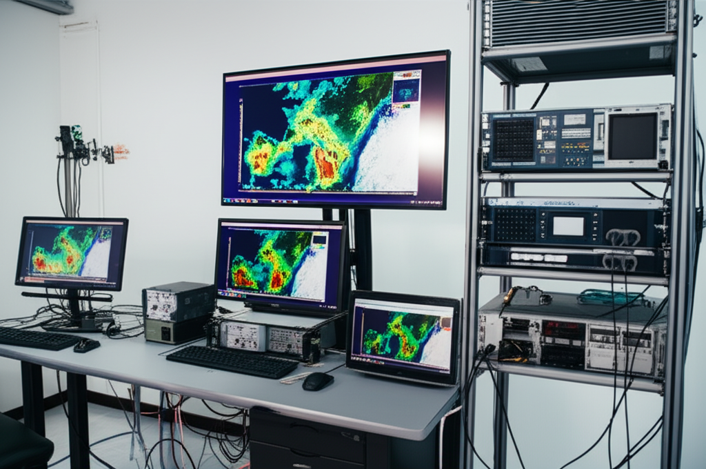
The Diploma in Spatiotemporal Telemetry and Risk Mapping integrates advanced techniques in geographic data analysis, remote sensing, and geographic information systems (GIS) for the analysis and modeling of terrestrial and spatial phenomena. It focuses on the application of methodologies for creating risk maps, environmental monitoring, and studying spatiotemporal changes, using tools such as satellite imagery, LiDAR data, and geoprocessing techniques. It is crucial for decision-making in areas such as natural disaster management, urban planning, and scientific research. The program provides practical knowledge in the use of specialized software and data interpretation, preparing students for the development of predictive models and the visualization of geospatial data. It addresses the use of GPS/GNSS systems for the collection of accurate data and the analysis of time series, focusing on compliance with standards and applicability across various disciplines. Target keywords (natural in the text): telemetry, spatiotemporal, risk maps, remote sensing, GIS, geoprocessing, satellite imagery, geospatial modeling.
Diploma in Spatiotemporal Telemetry and Risk Maps
- Format: Online
- Duration: 8 months
- Hours: 900 H
- Language: ES / EN
- Credits: 60 ECTS
- Registration date: 04-07-2026
- Strat date: 14-08-2026
- Available places: 4
1.180 $
Competencias y resultados
Qué aprenderás
1. **Spatiotemporal Analysis and Risk Map Design: Diploma in Applied Telemetry**
Para quien va dirigido nuestro:
Diploma in Spatiotemporal Telemetry and Risk Maps
Module 9 — Introduction to Space Telemetry
9.9 Telemetry Fundamentals: Definition, principles, and key components.
9.9 History and Evolution of Space Telemetry.
9.3 Applications of Telemetry in Space.
9.4 Sensors and Space Data Acquisition Devices.
9.5 Communication and Data Transmission Systems.
9.6 Introduction to Earth Orbit and its Classifications.
9.7 Ground Stations and Data Reception Networks.
9.8 Introduction to Telemetry Data Analysis: Data Types and Formats.
9.9 Software and Tools for Data Analysis.
9.90 Trends and Future of Space Telemetry.
Proyectos tipo capstones
- Maritime Risk Analysis: Evaluation of routes and hazardous areas using spatiotemporal data.
- Fleet Modeling: Simulation of naval movements and resource management.
- Oceanographic Risk Maps: Creation of interactive maps with telemetry data.
- Maritime Event Prediction: Development of predictive algorithms for safety.
- Naval Emergency Management: Marine disaster response platform.
- Sensor Data Analysis: Integration and visualization of navigation data.
Admisiones, tasas y becas
¿Tienes dudas?
Nuestro equipo está listo para ayudarte. Contáctanos y te responderemos lo antes posible.